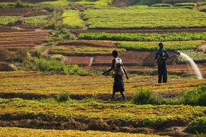
![]() A quiet, green miracle has been growing in the Sahel
A quiet, green miracle has been growing in the Sahel![]() .
.
Farmers in the western Sahel have achieved a remarkable success by deploying a secret weapon often overlooked in wealthier places: trees. Not planting trees. Growing them. Chris Reij, a Dutch environmental specialist at VU University Amsterdam who has worked on agricultural issues in the Sahel for thirty years, and other scientists who have studied the technique say that mixing trees and crops—a practice they have named “farmer-managed natural regeneration,” or FMNR, and that is known generally as agro-forestry—brings a range of benefits. The trees’ shade and bulk offer crops relief from the overwhelming heat and gusting winds. “In the past, farmers sometimes had to sow their fields three, four, or five times because wind-blown sand would cover or destroy seedlings,” said Reij, a silver-haired Dutchman with the zeal of a missionary. “With trees to buffer the wind and anchor the soil, farmers need sow only once.”
Leaves serve other purposes. After they fall to the ground, they act as mulch, boosting soil fertility; they also provide fodder for livestock in a season when little other food is available. In emergencies, people too can eat the leaves to avoid starvation.
The improved planting pits developed by Sawadogo and other simple water-harvesting techniques have enabled more water to infiltrate the soil. Amazingly, underground water tables that plummeted after the droughts of the 1980s had now begun recharging. “In the 1980s, water tables on the Central Plateau of Burkina Faso were falling by an average of one meter a year,” Reij said. “Since FMNR and the water-harvesting techniques began to take hold in the late 1980s, water tables in many villages have risen by at least five meters, despite a growing population.”
Some analysts attributed the rise in water tables to an increase in rainfall that occurred beginning in 1994, Reij added, “but that doesn’t make sense—the water tables began rising well before that.” Studies have documented the same phenomenon in some villages in Niger, where extensive water-harvesting measures helped raise water tables by fifteen meters between the early 1990s and 2005.
Click here for the full story
Originally published on the Scientific American website

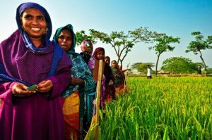 CGIAR has launched a new portfolio of research programs designed to reduce by 150 million the number of people suffering from hunger in developing nations. By transforming agricultural and food systems, the
 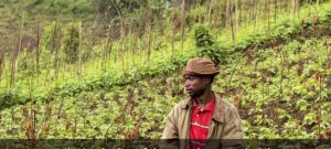 Trees for Food Security Project goal is to enhance food security for resource-poor people in rural Eastern Africa through research that supports national programmes to scale up the use of trees within farming systems in Ethiopia and Rwanda and then scale out successes to relevant ago-ecological zones in Uganda and Burundi.
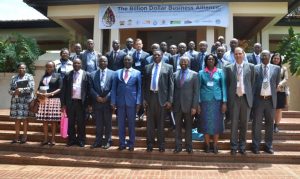 Water scarcity is a critical constraint to Kenya’s socioeconomic development and its achievement of vision 2030.On 11 April 2017, the Government and partners from the development and business communities launched the Kenya chapter of the Billion Dollar Alliance for Rainwater Harvesting, a continent-wide, multi-actor alliance designed to scale up farm pond technology for agribusiness and livelihood resilience for dry land farming systems.Kenya’s rainwater potential is more than 350 billion cubic meters. If captured and managed, this water is enough to support a population of 233 million people.This partnership is led by World Forestry Center and World Food Program.The main goal of this partnership is to increase farmers’ income and to improve food security. The partnership will provide technical, financial, policy and research support to the smallholder farmers.Impediments such as slow implementation and low technology adoption may hamper the realization of this process.However, the minister for water and irrigation reaffirmed the stakeholders of the government’s support in creating an enabling environment through proper policy implementation aimed at streamlining the government’s Water Sector and increase access to clean water for all in adequate quantity and quality at an affordable price as envisaged in Vision 2030 and the Constitution of Kenya.
 Food and Agriculture Organization (FAO) recently launched the Water Productivity Open Access Portal (WaPOR) to monitor and report on agriculture water productivity over Africa and the Near East.